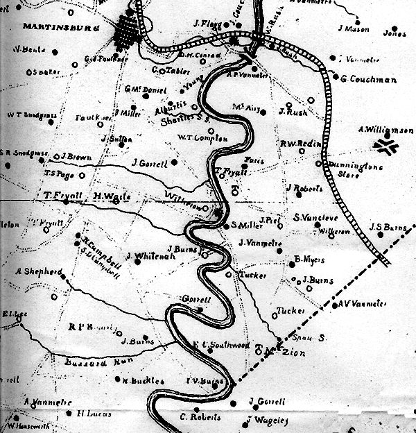
1847 map of Opequon Creek in Berkeley County VA
courtesy of http://www.xmission.com/~whitnahd/Berkeley1847.html
|
|
1847 map of Opequon Creek in Berkeley County VA courtesy of http://www.xmission.com/~whitnahd/Berkeley1847.html |
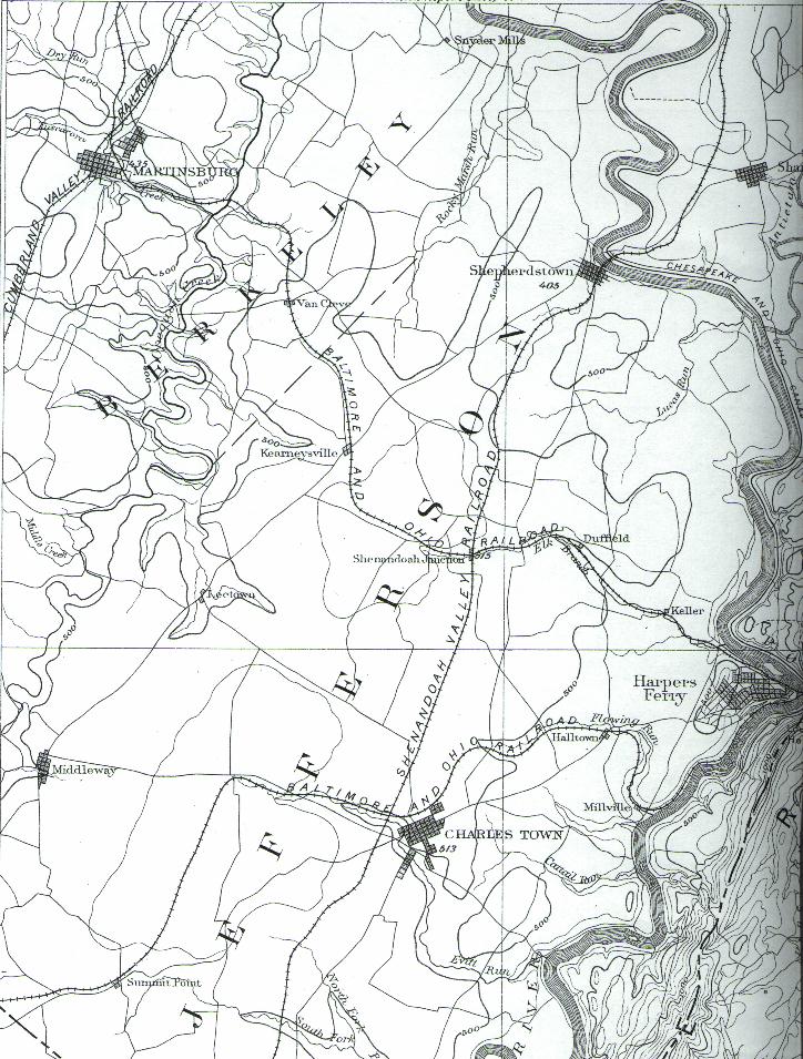
1893 U.S. Geological Survey Map of
the Opequon Area
Surveyed in 1884, this is the 1893
edition as reprinted in 1916 (with a note adding "This map is out of date;
revision is planned"). Comparison to the hand-drawn 1847 map allows us to
pinpoint William Burns [Sr.]'s estate (inherited by "J. Burns Jr.") in the bend
of the Opequon to the right of the first "E" in BERKELEY, about
three miles northeast of Kearneysville. The estate of Isaac Van Meter
Burns ("I. V. Burns," son of William [Jr.]) would be in the bigger bend to the
south, on the Berkeley/Jefferson county border due east of Kearneysville; with
E.C. Southwood's place and the Mt. Zion Baptist Church just to its north.
Martinsburg, Shepherdstown, Charles Town, Harpers Ferry, and the Baltimore &
Ohio Railroad(s) are all featured; Antietam Creek can be seen in the upper right
corner, east of the Potomac; and the wealth of lines in the lower right corner
is a glimpse of the Blue Ridge.
click here to
return to Fine Lineage